Rotherham Hospital
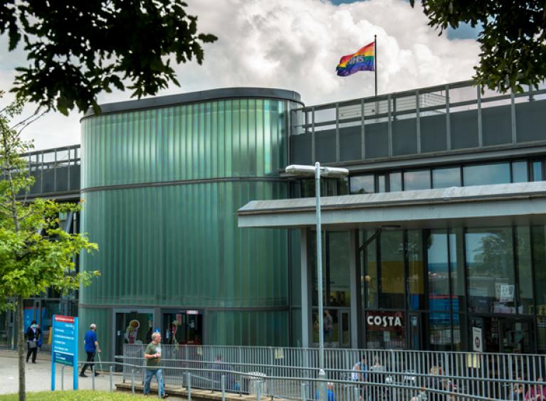
Rotherham Hospital first opened on 6 March 1978. It is our main site with 370+ beds providing a range of hospital based medical, surgical, paediatric and obstetric & gynaecological services.
The clinical services are supported by comprehensive pathology, medical physics and imaging services, including state of the art MRI and CT facilities.
Our Medical Education Centre has tutorial rooms and a lecture theatre. The Medical Library and information systems are widely acclaimed.
The Rotherham Hospital site also acts as a base for:
- Post and Undergraduate Education for Sheffield University
- Rotherham Metropolitan Borough Council hospital-based Social Services
- Renal Unit, managed by Sheffield Teaching Hospitals NHS Foundation Trust
- Busy Bees Day Nursery
Address
Rotherham Hospital
Moorgate Road
Rotherham
S60 2UD
Switchboard: 01709 820000
Wheelchairs
There is a wheelchair station in the main entrance of the hospital. You will need £1 coin or a trolley token to release a wheelchair.
Please return the wheelchair to the wheelchair station after use to release your £1 coin or trolley token, helping us to make sure there are wheelchairs available for those who need them.
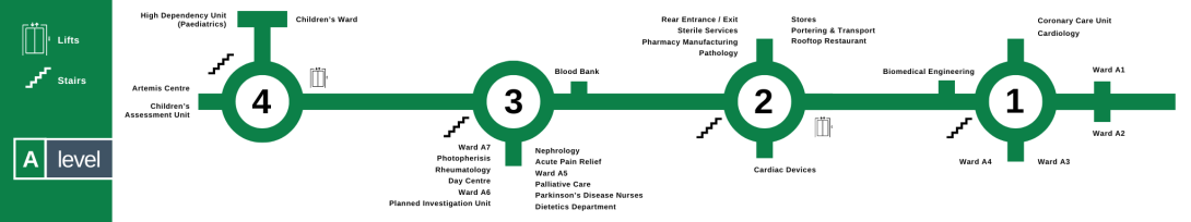
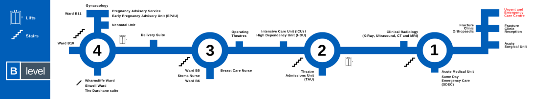
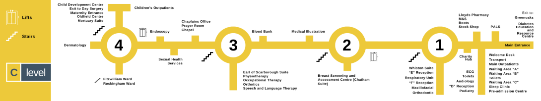
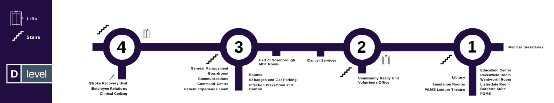
Finding your way around Rotherham Hospital
Each floor of the hospital has a letter, with A being at the top of the building.
Each floor has 4 junctions which have staircases. Lifts are available at junctions 2 and 4.
Shops and catering
Rooftop Restaurant
The Rooftop Restaurant is located on A level and provides a range of hot and cold food and drinks for visitors and staff.
The restaurant is open Monday to Friday.
Breakfast is served from 8am to 11am.
Lunch is served from 11.30am to 2pm.
Retail
There are several shops in the hospital's main entrance, including:
- A florist
- Boots
- M&S Food
- Stock Shop
- Costa Coffee
- Numark Pharmacy